
The weather has been active regularly for the past few days. Meteorologists have predicted that this year will experience more rain than average and more casualties than the previous year. There is a high risk of landslides in the hilly areas and there are more incidents of floods, landslides, landslides, erosion and destruction in the Terai region due to rainfall. Local authorities have developed various plans for managing, rescuing, and providing relief for floods and landslides caused by heavy rains. They have been actively involved in immediate rescue and relief efforts, utilizing relief funds and conducting public awareness campaigns to reduce potential risks. In this context, the five local heads of Kapilvastu district have made countermeasure plans to reduce the risk of disaster during the rainy season. Regarding this matter, an edited part of the conversation prepared by INSEC Kapilvastu District Representative Rima BC as a representative is presented here.
Chakrapani Aryal
Mayor, Badganga Municipality, Kapilvastu
Badganga Municipality has formed a local-level disaster management committee that includes multi-sectoral stakeholders to effectively manage disasters. The committee has developed and implemented various pre-disaster plans to enhance preparedness. While preparing the counteraction plans, the committee identified risk areas within the local level and developed an action plan addressing these areas. The plan includes the allocation of necessary human resources, tools, and relief materials to mitigate potential disasters. Settlements along the east-west banks of the Badganga River and the Koili River are at risk in Badganga Municiapality. We have alerted the local residents accordingly and, after assessing the potential disaster, have provided various rescue materials to the security personnel for their response efforts. We are collaborating with the District Level Disaster Management Committee and have analyzed the situation in all wards within the local level to advance our disaster management efforts.In addition, we have informed citizens in risk areas to remain aware. As women, pregnant women, people with disabilities, and senior citizens are particularly vulnerable, we have developed plans to address these issues with sensitivity and ensure that everyone is adequately alerted.

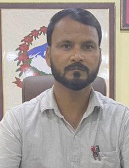
Sudip Poudel
Mayor, Kapilvastu Municipality, Kapilvastu
Ward No. 3, 4, and 12 of Kapilvastu Municipality are currently at high risk of floods and landslides. The situation is particularly concerning in Akbarpur, as it is directly affected by the Badganga River which flows through the area. Additionally, the municipality is also experiencing erosion issues caused by flooding.In response, the local disaster management committee is proactively developing various plans to address these challenges and mitigate the impact on the community. We have alerted locals to move to safer locations as surrounding settlements face increased risk due to rising water levels in the Badganga River. We have coordinated with the district-level disaster management committee to make relief arrangements for families whose houses have been destroyed. Likewise, we have identified disaster risk areas and developed an action plan to reduce these risks. Additionally, we are moving forward with plans in coordination with various stakeholders to effectively manage and carry out rescue operations. We have handed over rescue materials to the Armed Police Force to aid in rescuing people in difficulty. We have been assessing potential local-level disasters in advance, creating a proactive plan, and coordinating with rescue materials, rescue workers, and security personnel.

Ajay Thapa
Mayor, Shivaraj Municipality, Kapilvastu
Geographically, Shivaraj Municipality encompasses both hilly and Terai areas, leading to a higher risk of landslides in the Dhankhola area. Meanwhile, settlements near the Surai River in Ward No. 2, Hallanagar, are at risk of flooding. Ten houses are at risk due to flooding from the Surai River. These houses are located just ten meters away from the flood zone. Additionally, the floodwaters have swept away the embankment. sandbags are being used to stop the floodwaters from entering the settlement after the embankment was swept away. We have asked the at-risk families to move to a safe place and secure their belongings. To reduce disaster risk, the local authorities are identifying risk areas, managing information flow, and ensuring the availability of rescue materials and security personnel. Among the displaced, priority for rescue will be given to senior citizens, people with disabilities, pregnant women, and new mothers.
Kamlesh Saran Chaudhary
Chairperson of Suddhodhan Rural Municipality
Suddhodhan Rural Municipality is a Rural Municipality that shares a border with India. In its southern part, there is a large river formed by joining the Beti and Marti Rivers. When India closes its doors during heavy rains, our area gets flooded. However, the problem of landslides is not as severe at our local level. During the rainy season, floods cause significant trouble in this area. All the paddy crops are destroyed and farmers are unable to harvest the crops they planted with great effort. Most of the cultivable land in areas like Phulwapur, the eastern border of Dohani, Ghiraujot, and Lodhavi in Ward No. 5 of Shuddhodhan Rural Municipality is flooded. The floods have completely destroyed paddy crops in Khoriya and Prassiya. The graveled roads in Ward No. 5 have been damaged by the Sano Karma and Thulo Karma Beti Rivers from Harnampur and Asurainya. The local level is working to form blockades and address the areas where there is flooding by identifying such risk areas. The embankments built during the implementation of counteraction plans have been eroded due to high water flow. In some areas, when India closed the doors, it caused problems, so we have coordinated with the Disaster Management Committee and moved forward in addressing the issue.

Baliuddin Musalman
Chairperson, Mayadevi Rural Municipality
Mayadevi Rural Municipality faces significant flood challenges. Jamuniya river is located in the southern part of this locality. Since it is one of the borders of India, India closes its doors when it rains heavily and there is a problem that all the cultivable land gets flooded. Now all the fields are flooded. The gates have been opened in coordination with India, but farmers are still suffering greatly. There is nothing the local authorities can do. Tulsidiya Lake in Pipara of Mayadevi Rural Municipality-4 is full, causing ongoing losses for people with their cultivable land. There are no other major problems at the local level. The disaster management committee has not yet held a meeting. Since the local authorities are currently unable to take further action, holding a meeting seems unnecessary at this moment.